
Spending three or four days in Taos allows you to fully transition into 'Taos Time,' a slower, more intentional pace of life. This itinerary balances the high-octane adventure of the Sangre de Cristo Mountains with the quiet, reflective beauty of the Rio Grande Gorge. By basing yourself in or near the historic town, you have easy access to both the high alpine environments to the north and the dramatic volcanic mesas to the west, all while enjoying the unique hospitality of Northern New Mexico.
Day 1: The Gorge and the Mesa
Start your first day by heading west out of town toward the Rio Grande Gorge Bridge. Arriving early allows you to beat the mid-day heat and the larger groups of tourists. Park on the western side of the bridge and take a walk across the span to feel the wind and see the river far below. After crossing, hop onto the West Rim Trail for a few miles of flat, scenic hiking. The views of the mountains across the flat mesa are some of the most expansive in the state. Keep a lookout for the bighorn sheep that frequent the canyon rim.
In the afternoon, continue west to visit the Greater World Earthship Community. These unique, sustainable homes are built from recycled materials and are entirely self-sufficient. Taking a self-guided tour of the visitor center offers a fascinating perspective on desert living. Head back toward town for dinner near the Taos Plaza, where you can walk through the historic streets and browse the local galleries. The first day is best kept at a lower elevation to help your body acclimate to the 7,000-foot altitude of the town before you head higher into the mountains.
Day 2: Alpine Heights in Taos Ski Valley
On your second day, drive twenty miles north and climb several thousand feet into the Taos Ski Valley. In the summer and fall, this is your base for high-altitude hiking. The trail to Williams Lake is a highly recommended moderate hike that leads to a stunning alpine lake nestled at the base of the Wheeler Peak wilderness. If you are feeling ambitious and have started very early, you can continue past the lake to the summit of Wheeler Peak, the highest point in New Mexico. The views from the top span all the way into Colorado.
If you prefer something less strenuous, the chairlift often runs during the summer months, providing a 'scenic ride' that whisks you up to the high ridges without the climb. Lunch at the base of the mountain offers a chance to enjoy the cool mountain air and the alpine scenery. In the winter, this entire day would be dedicated to the slopes, exploring the world-famous terrain of the ski resort. Whatever the season, the drive back down the canyon at sunset is a beautiful experience as the light hits the rock walls of the Hondo Canyon.
Day 3: The Enchanted Circle and Hidden Valleys
Use your third day to drive a portion of, or the entire, Enchanted Circle Scenic Byway. Head north through the town of Questa, stopping at the Wild Rivers Recreation Area. This hidden gem is where the Red River meets the Rio Grande; the 'La Junta' overlook provides a spectacular view of the confluence from the canyon rim. There are several steep trails here that lead down to the river for those who want one last challenging hike. The solitude here is often a highlight for visitors looking to escape the busier spots near town.
Continue the loop toward the town of Red River, a charming mountain outpost with a distinctly different feel than Taos. It is a great place to grab lunch and walk along the river that runs right through the center of town. If you have time, finish the loop through Eagle Nest and Angel Fire, passing by the large high-mountain lake. This drive provides a complete overview of the region's geography, from volcanic canyons to lush alpine meadows. Return to Taos in the evening for a final celebratory meal, perhaps trying some local dishes featuring the famous New Mexican green chile.
Day 4: Hot Springs and Relaxation (Optional)
If you have a fourth day, dedicate it to relaxation and soaking in the natural beauty. The region is famous for its thermal waters. You can visit a developed hot springs resort for a luxurious soak in various pools of different temperatures, or seek out the more primitive 'Black Rock' or 'Manby' hot springs located along the banks of the Rio Grande. Reaching these natural pools requires a short hike and a drive down a rugged dirt road, so check local conditions and vehicle requirements before heading out.
After a morning soak, spend your afternoon exploring the shops and museums you may have missed. The Couse-Sharp Historic Site or the Harwood Museum of Art offer deep dives into the creative history of the area. Alternatively, head to the South Boundary Trail for a final mountain bike ride or a short walk. This trail is legendary among cyclists for its long, flowing descents through the forest. Ending your trip with a mix of physical activity and relaxation perfectly encapsulates the Taos lifestyle. Always ensure you are leaving no trace and respecting the natural environments you visit.
Travel Tips and Logistics
Taos is best explored with a vehicle, as public transportation to trailheads is limited. If you are flying in, most visitors use the Albuquerque International Sunport, which is about a two-and-a-half-hour drive south. There are also smaller regional flight options directly into the Taos Regional Airport, though these are less frequent. When planning your drives, remember that mountain miles take longer than highway miles; winding roads and elevation changes mean you should allow extra time to reach your destinations safely.
Cell service can be spotty once you leave the main town area and head into the canyons or the national forest. It is a good idea to download offline maps and carry a physical map of the Carson National Forest. Hydration is key; the dry air and high altitude can lead to altitude sickness if you aren't careful. Drink significantly more water than you think you need. Lastly, always check the official NPS or Forest Service websites for the latest on fire restrictions, as Northern New Mexico can be prone to dry conditions during the late spring and early summer.
More ways to book Taos
 Illustrative · Diego Angel
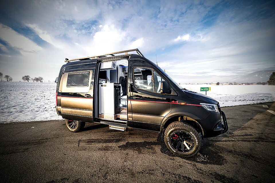
Sprinter Adventure Van
Small enough to park at the trailhead, comfy enough to sleep in.
$189/day (estimate)
Direct link · RVshare