
Embarking on a Blue Ridge Parkway itinerary is a journey through the heart of the Appalachian landscape, covering hundreds of miles of scenic vistas and historic landmarks. This four-day plan focuses on the central and southern sections, where the elevations are highest and the scenery is most dramatic. Starting near the Virginia border and heading south toward the Great Smoky Mountains, this route ensures you see the most iconic highlights while allowing time for hiking and local culture. Prepare for a slow-paced adventure where the journey truly is the destination.
Day 1: High Meadows and Historic Mills
Start your journey in the northern section near the Virginia-North Carolina border. Your first major stop should be Mabry Mill at Milepost 176. This is the perfect place to enjoy a traditional mountain breakfast and walk the short trail around the historic mill and blacksmith shop. After soaking in the history, continue south to Doughton Park at Milepost 238. This area features expansive open meadows that are ideal for a midday picnic or a hike along the Bluff Mountain Trail.
The afternoon can be spent exploring the Brinegar Cabin to see how mountain families lived in the late 1800s. As the sun begins to set, head toward the town of Blowing Rock or Boone for your first night's stay. These gateway towns offer a variety of dining options and local shops. The drive today covers rolling hills and pastoral landscapes, providing a gentle introduction to the more rugged terrain you will encounter in the coming days. Make sure to fill your gas tank in town, as fuel is not available directly on the parkway.
Day 2: Grandfather Mountain and the Viaduct
On your second day, the terrain becomes more dramatic as you enter the High Country. Begin early at the Moses H. Cone Memorial Park at Milepost 294. You can tour the Flat Top Manor or walk the easy carriage trails around Bass Lake. From there, it is a short drive to the iconic Linn Cove Viaduct. Be sure to stop at the visitor center at Milepost 304 to learn how this complex bridge was built to protect the fragile environment of Grandfather Mountain.
Continue south to Julian Price Memorial Park, where you can rent a boat or hike the loop trail around the lake. The highlight of the afternoon will be Linville Falls at Milepost 316. Several trails lead to different vantage points of the spectacular falls dropping into the Linville Gorge. Finish your day by heading toward the Spruce Pine or Little Switzerland area. This section of the parkway offers some of the most continuous high-elevation views, so keep your camera ready for the late afternoon light hitting the ridges to the west.
Day 3: The Highest Peaks and Asheville Culture
Day three takes you to the highest point in the eastern United States. Head toward Mount Mitchell State Park, accessed via Milepost 355. You can drive nearly to the summit and take a short paved walk to the observation deck for a breathtaking view from 6,684 feet. Afterward, make your way to the Craggy Gardens area at Milepost 364. If you are visiting in June, the purple rhododendrons here are world-famous. The Craggy Pinnacle hike is a must-do for its panoramic mountain vistas.
By mid-afternoon, you will reach the Asheville area. Take some time to visit the Blue Ridge Parkway Visitor Center and the Folk Art Center to see local Appalachian crafts. Asheville serves as a great base for your third night, offering a vibrant downtown scene with numerous farm-to-table restaurants and galleries. This part of the itinerary allows for a mix of high-altitude wilderness and the comforts of one of the South's most beloved mountain cities. It is a good time to rest and recharge for the final leg of the journey.
Day 4: The Great Balsams and Waterfalls
The final day of your itinerary covers the southernmost and highest section of the parkway. Leaving Asheville, head toward Mount Pisgah at Milepost 408. There are several excellent hiking trails here, or you can simply enjoy the views from the Pisgah Inn. Continue to Graveyard Fields at Milepost 418, a unique valley known for its waterfalls and wild blueberries. The landscape here feels different from the rest of the parkway, with stunted trees and rocky terrain that resemble a more northern climate.
As you approach the end of the parkway, stop at the Richland Balsam Overlook at Milepost 431, the highest point on the motor road. The final stretch takes you through the Plott Balsam Mountains and down into the Great Smoky Mountains National Park near Cherokee, North Carolina. This end point is perfect for those who want to continue their adventure into the Smokies. Reflect on the 469 miles of beauty you've traversed. Before heading to the nearest airport in Asheville or Charlotte, check the official NPS site one last time to confirm your exit route and any local road alerts.
Travel Tips for a Smooth Journey
A successful Blue Ridge Parkway itinerary requires a bit of logistical planning. First and foremost, remember that the speed limit is 45 mph or lower in most sections. This is a road designed for leisurely travel, not for commuting. There are no gas stations on the parkway itself, so you will need to exit into gateway towns to refuel. Most of these towns are located within 10 to 20 minutes of the parkway exits. Cell service is notoriously unreliable in the mountains, so download offline maps or carry a physical road atlas.
Packing for a variety of weather is also essential. Even in the height of summer, high-elevation spots can be chilly and windy. Bring layers, rain gear, and plenty of snacks, as dining options on the road are limited to a few seasonal lodges. Finally, always check the official National Park Service website for real-time road closures. Tunnels, maintenance, or weather events can cause temporary detours. By staying flexible and prepared, you can fully immerse yourself in the natural wonder of the Blue Ridge without the stress of the unknown.
More ways to book Blue Ridge Parkway
 Illustrative · Diego Angel
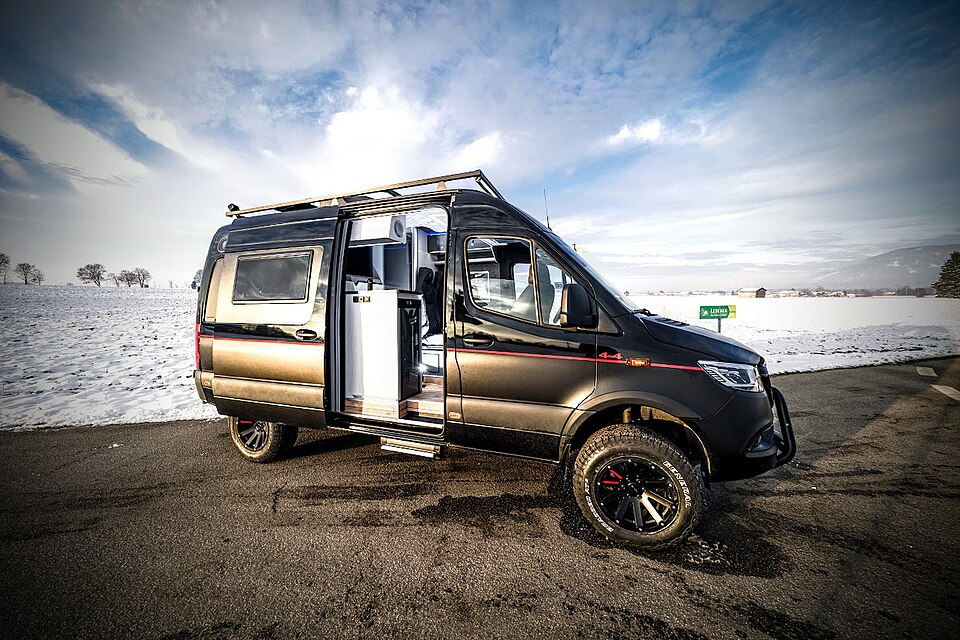
Sprinter Adventure Van
Small enough to park at the trailhead, comfy enough to sleep in.
$189/day (estimate)
Direct link · RVshare