
Lassen Volcanic National Park is a hidden gem in Northern California, offering a landscape shaped by all four types of volcanoes. From the roiling steam vents to the crystal-clear alpine lakes, the park provides an outdoor playground for adventurers of all levels. Whether you are looking for a strenuous summit hike or a relaxing day by the water, the diversity of the terrain ensures there is something unique to discover around every bend in the road.
Witness the Power of Bumpass Hell
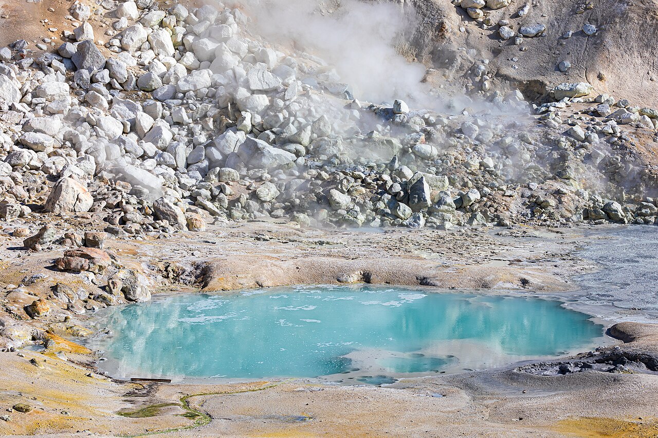
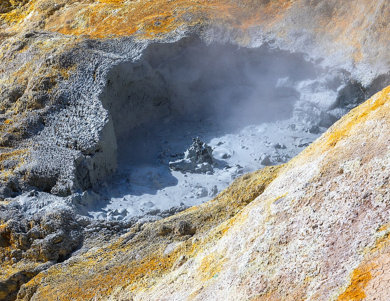
No visit to the park is complete without seeing Bumpass Hell, the largest hydrothermal area in Lassen. A moderate three-mile round-trip hike leads you into a basin filled with roaring steam vents known as fumaroles, bubbling mud pots, and boiling pools colored in shades of turquoise and orange. The smell of sulfur hangs thick in the air, a constant reminder of the volcanic heat beneath your feet.
The trail features a boardwalk that allows you to safely navigate the unstable, acidic ground. It is vital to stay on these designated paths, as the crust is thin and the water underneath is scalding. Along the way, you will enjoy sweeping views of the surrounding peaks and the remains of ancient volcanoes. The hydrothermal activity is most impressive in the morning when the cool air makes the steam clouds appear larger and more dramatic. This is a must-do for anyone interested in the raw, geological forces that continue to shape the California landscape today.
Conquer the Summit of Lassen Peak
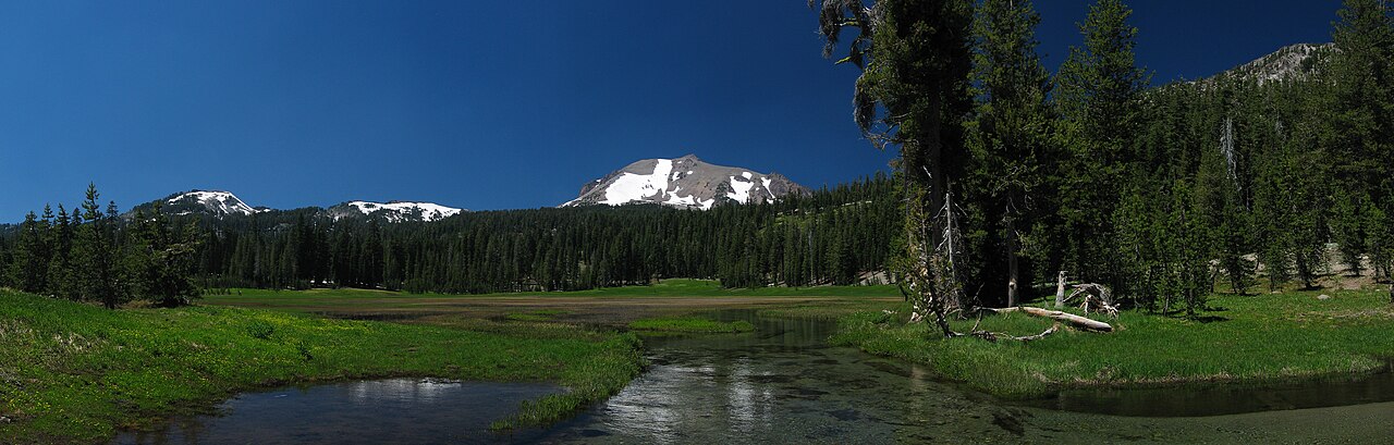
For those seeking a physical challenge, hiking to the top of Lassen Peak is the premier experience. As one of the largest plug dome volcanoes in the world, the summit sits at an elevation of 10,457 feet. The trail is approximately five miles round-trip and gains about 2,000 feet in elevation, making it a strenuous climb that requires plenty of water and sun protection.
The path zigzags up the rocky slopes, offering increasingly spectacular views of the Devastated Area and the distant Mount Shasta to the north. Once you reach the top, you can peer into the crater left by the 1915 eruption and see the jagged volcanic rocks scattered across the landscape. The sense of accomplishment at the summit is matched only by the panoramic views of the entire park and the surrounding wilderness areas. Even in mid-summer, patches of snow often remain near the peak, adding to the high-alpine atmosphere of this classic California trek.
Explore the Cinder Cone and Painted Dunes
Located in the more remote northeast corner of the park near Butte Lake, the Cinder Cone hike offers a landscape that feels like another planet. This perfectly symmetrical volcanic cone was formed by eruptions in the 1650s. The trail to the base is relatively flat, but the final ascent up the loose volcanic scoria is steep and challengingâfor every two steps forward, you might slide one step back.
From the rim of the Cinder Cone, you can look down into two distinct craters and see the Fantastic Lava Beds, a massive flow of basaltic lava. Beyond the lava lies the Painted Dunes, rolling hills of volcanic ash oxidized into vibrant shades of red, orange, and gold. The contrast between the black lava and the colorful dunes is a photographer's dream. This area is less crowded than the main park corridor, offering a rugged and quiet experience for those willing to drive the gravel road to the Butte Lake trailhead.
Relaxation and Water Activities at Manzanita Lake
If you are looking for things to do in Lassen Volcanic that are a bit more relaxed, Manzanita Lake is the place to be. Located near the north entrance, this area is ideal for families and casual explorers. The lake is famous for its reflection of Lassen Peak, which is best captured during the 'golden hour' just before sunset. A gentle 1.5-mile loop trail circles the water, offering easy walking and great birdwatching opportunities.
The lake is also a hub for non-motorized water sports. You can rent kayaks or paddleboards to explore the shoreline, or try your hand at catch-and-release fly fishing for wild trout. The nearby campground and museum provide context on the park's history and the 1915 eruption. Even on a rainy day, the Manzanita Lake area remains accessible and beautiful, with the mist hanging low over the water and the tall pines providing a sense of seclusion. It is the perfect spot for a picnic or to simply sit and soak in the mountain air.
Scenic Drives and Roadside Wonders
For those with limited time or mobility, the 30-mile Lassen Park Highway provides a spectacular overview of the parkâs highlights. The drive itself is an engineering marvel, winding through high mountain passes and reaching an elevation of 8,512 feet at its highest point. Along the way, there are numerous pullouts where you can see sights like the Sulphur Works, which is the most accessible hydrothermal area in the park, located just a short walk from the road.
You will also pass Emerald Lake and Lake Helen, both known for their deep, sapphire-blue waters that often remain frozen until July. The Devastated Area trail offers a short, interpretive walk through the path of the 1915 mudflow, showcasing massive volcanic boulders thrown miles from the summit. This drive allows you to see the park's transition from dense forest to volcanic barrens and back again. Be sure to check the official NPS site for road conditions, especially in the early summer, to ensure the entire pass is open for your trip.