
The Needles Highway is more than just a scenic drive; it is a gateway to some of the most iconic landscapes in the American West. Stretching 14 miles through the heart of Custer State Park, this road offers a blend of architectural engineering and natural wonder. Visitors come to marvel at the towering granite fins that pierce the sky and to test their driving skills through narrow tunnels carved directly into the rock. Whether you are an avid hiker, a photography enthusiast, or a family on a road trip, the highway and its surrounding trails provide a wealth of outdoor experiences that define the Black Hills spirit.
Navigate the Iconic Tunnels and Spires
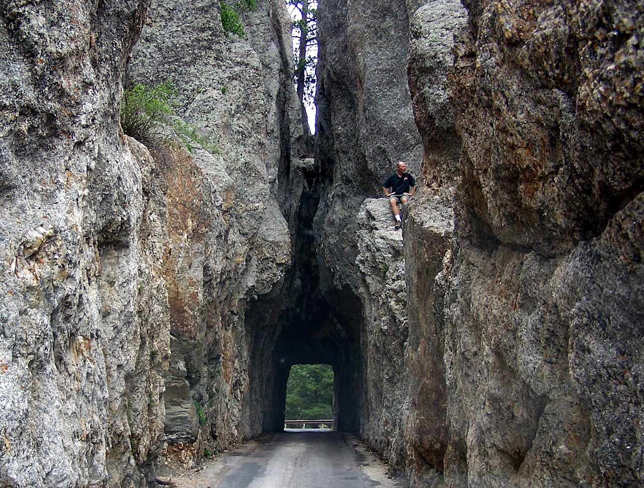
The primary activity on the Needles Highway is the drive itself, which requires focus and a slow pace. The road was famously deemed 'impossible' to build by engineers in the early 20th century, but today it stands as a masterpiece of scenic design. The most famous landmark is the Needle's Eye Tunnel, named for a specific rock formation that looks remarkably like the eye of a needle.
Driving through this tunnel, which is extremely narrow, is a rite of passage for Black Hills visitors. Be sure to pull over at the designated overlooks to snap photos of the 'needles'âslender granite pillars that reach toward the clouds. These formations were created by millions of years of erosion, leaving behind the hard granite cores. The drive usually takes about 45 to 60 minutes without stops, but you should budget at least two hours to truly appreciate the craftsmanship of the road and the scale of the rock formations that flank every curve.
Hike the Cathedral Spires Trail
To get a closer look at the geology of the region, the Cathedral Spires Trail is a must-do activity. This moderate hike is approximately 1.5 miles round-trip and takes you directly into the base of the massive granite pillars you see from the road. The trail is well-marked and relatively short, but it does involve some elevation gain and rocky terrain, so sturdy footwear is recommended.
As you hike, the spires loom larger and larger until you are surrounded by a natural amphitheater of stone. This area is also a favorite for rock climbers, and if you look closely, you might spot people ascending the sheer faces of the granite. The quiet atmosphere inside the spires provides a stark contrast to the busy highway. It is a fantastic place for bird watching or simply sitting on a boulder to soak in the ancient energy of the Black Hills. Remember to stay on the designated paths to protect the fragile alpine vegetation that grows at the base of the rocks.
Relax at Sylvan Lake
Often referred to as the 'crown jewel' of Custer State Park, Sylvan Lake sits at the northern end of the Needles Highway. This man-made lake is framed by enormous boulders that reflect perfectly in the calm water. It is a popular spot for swimming, paddleboarding, and kayaking during the summer months. You can rent non-motorized watercraft at the shore, providing a peaceful way to explore the lake's hidden coves and rock walls.
For those who prefer to stay on land, the Sylvan Lake Shore Trail is an easy, flat loop that circles the water and takes you behind some of the largest rock formations. It is highly accessible and perfect for families with young children. The lake area also serves as a trailhead for more strenuous adventures, including the path to Black Elk Peak. Whether you are looking for a rigorous workout or a quiet place for a picnic, Sylvan Lake offers a versatile landscape that complements the craggy intensity of the highway drive.
Summit Black Elk Peak
For hikers seeking the ultimate view, the trek to Black Elk Peak (formerly Harney Peak) starts near the Needles Highway at Sylvan Lake. This is the highest point in South Dakota and the highest point in the United States east of the Rocky Mountains. The hike is roughly 7 miles round-trip and takes several hours, but the reward is a 360-degree view of the Black Hills, including the distant Badlands on a clear day.
At the summit, you will find a historic stone fire lookout tower built by the Civilian Conservation Corps in the 1930s. The tower itself is an architectural marvel, blending seamlessly into the granite peak. The trail winds through pine forests and past smaller granite outcrops, offering a different perspective of the ecosystem than what you see from the car window. Because of the elevation, it can be significantly cooler and windier at the top, so hikers should bring extra layers and plenty of water. It is a challenging but deeply rewarding way to experience the scale of the region.
Wildlife Spotting and Photography
While the Needles Highway is famous for its rocks, the surrounding Custer State Park is one of the best places in the country to see North American wildlife. As you approach or depart the highway, keep your eyes peeled for mountain goats, which are frequently seen perched precariously on the granite cliffs. These white-furred climbers are well-adapted to the steep terrain and are a highlight for many visitors.
Lower down in the meadows, you may encounter white-tailed deer, elk, and wild turkeys. While the famous bison herds are more common on the Wildlife Loop Road to the south, they occasionally wander near the Needles. For photographers, the 'golden hour'âthe hour after sunrise and the hour before sunsetâprovides the best lighting for capturing the textures of the granite and the soft colors of the forest. Always maintain a safe distance from all animals, especially bison and mountain goats, as they are wild and can be unpredictable. Using a zoom lens is the best way to get a great shot while respecting the animals' space.